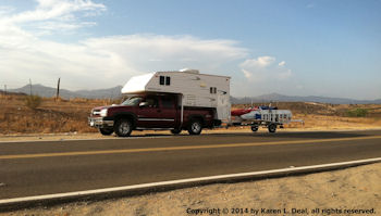
Driving a car in any country can be a challenging experience for tourists. In Mexico, traffic signs are in Spanish, speed limits and distances are in kilometers and traffic lights can be ambiguous. Furthermore, driving practices and customs often differ from those in the U. S.
Tips on the following subjects are designed to help tourists prepare for a less-stressful driving experience in Mexico:
Mexican Maps and Road Information for Mexico
Mexican Automobile Insurance and Permits for Driving in Mexico
Automobile GPS and Navigator Card for Mexico
Using The Metric System in Mexico
Traffic Signs and Signals in Mexico
Mexican Speed Bumps and Toll Roads in Mexico
Other Useful Items for Driving in Mexico
Mexican Maps and Road Information for Mexico
Current Mexican maps are essential, and one of the best is the Guia Roji atlas, a 152 page set of detailed maps that is updated frequently (purchase the latest possible version). It is obtainable at Mexican bookstores, and in the U.S. at selected locations such as the Tucson Map & Flag Center in Tucson, Arizona. Country maps and other information regarding roads and highways also can be obtained from organizations such as AAA.
Mexican Automobile Insurance and Permits for Driving in Mexico
Insurance should be purchased before entering Mexico, and is widely available. Prices vary considerably, and an annual policy (rather than purchasing insurance by the day) likely will prove cost effective for trips longer than ten days.
Car permits are not required in Baja California or most of Sonora from Guaymas north, but are otherwise necessary. They should be obtained at or near border crossings, in order to avoid time-consuming back-tracking. If unsure where these locations are, ask at the Mexican border customs office. To obtain a permit (temporary vehicle importation license), you will need a passport, driver’s license, original and current registration, a copy of the vehicle title, a credit card and copies of all of the above.
Automobile GPS and Navigator Card for Mexico
A GPS with a set of Mexican maps, such as the Garmin 255W and Garmin Mexican Navigator Card (010-10755-00), will prove invaluable for driving in Mexico, even though they are far from infallible. A GPS with spoken instructions is particularly useful, and should be set to vocalize directions without naming streets, since these devices tend to mispronounce streets and the streets in Mexico are not always clearly signed.
In general, a GPS should be used in Mexico, but not relied upon exclusively. Watch highway signs as well, and choose a well-marked route over contradictory GPS directions which are probably dated. Also check for one-way signs before following a GPS instruction to turn.
Using the Metric System in Mexico
Mexico uses the metric system—distances are measured in meters and kilometers and speed limits are expressed as kilometers per hour. Approximate conversion of kilometers to miles can be done by dividing by 10 and multiplying this answer by 6. For example, 100 kilometers divided by 10 is 10, times 6 is 60 miles.
A meter is slightly more than 3 feet and 1 kilometer is about 6 tenths of a mile.
Speed limits are expressed in even kilometers per hour, generally from 20 to 110, and the following table gives the approximate miles-per-hour equivalents:
20 kmh (12 mph)
30 kmh (20 mph)
40 kmh (25 mph)
50 kmh (30 mph)
60 kmh (35 mph)
70 kmh (40 mph)
80 kmh (50 mph)
90 kmh (55 mph)
100 kmh (60 mph)
110 kmh (65 mph)
Traffic Signs and Signals in Mexico
Traffic signs are in Spanish, and drivers should learn the more common and important ones. Signals sometimes differ with what is found in the U.S. For example, flashing red lights mean essentially the same thing as flashing yellow lights—be cautious—but do not require a stop. In addition, left turns at signalled intersections are sometimes made from the left lane, as in the U.S., but in some places left turns must be made from the far right hand lane. Also, the car ahead of you with a blinking left turn signal may be signalling a left turn or may be telling you that the road ahead is clear enough to pass him. Drivers should carefully observe local drivers and practices.
Mexican Speed Bumps and Toll Roads in Mexico
Drivers in Mexico should expect to encounter lots of topes, or speed bumps. These are commonly used to reduce speed in congested areas, small towns and outlying areas of larger cities. Typically, they are substantial enough to require vehicles to slow close to a stop, and can seriously rattle, if not damage, the car that doesn’t. Drivers should learn to recognize and cope with topes.
Mexico has added numerous toll roads in the past few years, and drivers should take advantage of these whenever possible. Generally speaking, toll roads (cuotas, autopistas and maxpistas) are higher speed roads, reduce travel time, are in good condition (often with shoulders), are safer and don’t have speed bumps.
Other Useful Items for Driving in Mexico
A basic set of tools, pocket knife, flashlights and batteries
A basic set of kitchen tools, openers. glasses, coffee mugs, coffee grinder
Binoculars to check distant roadsigns
Compass, magnifying glass
Spanish dictionary
Extra batteries for powered items
Extension cord (surge-protected power strip if you carry a laptop)
Taking the time to research and prepare for a driving trip in Mexico will help make your journey more relaxed and enjoyable.


